HOME
ABOUT ME
PORTFOLIO
PORTFOLIO
Show all
GIS
Custom Code
Web Mapping
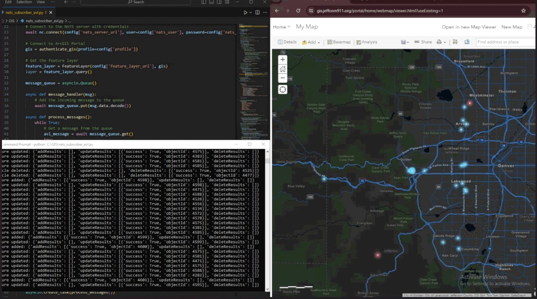
Mapping Incident and AVL Data with ArcGIS Python API
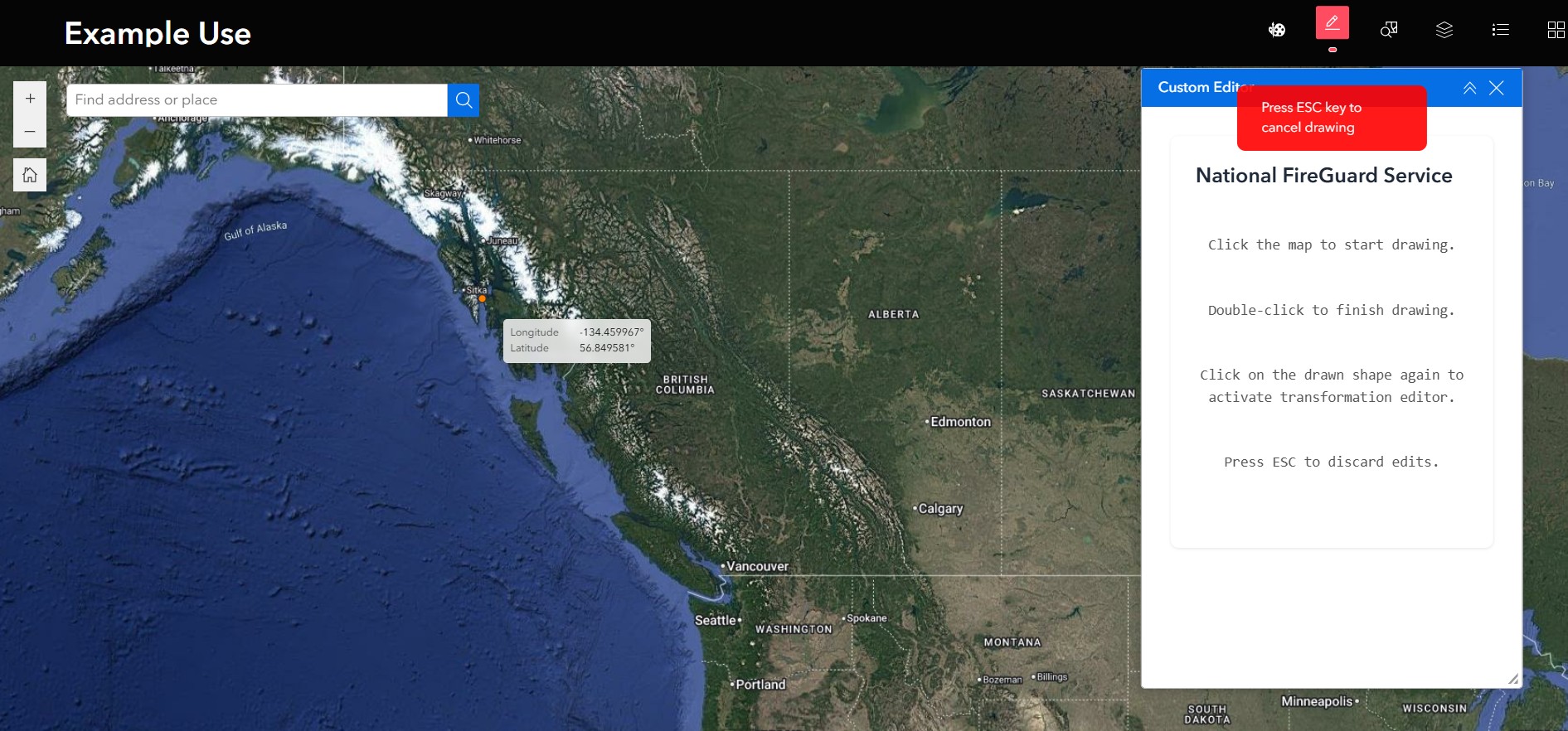
Custom Experience Builder Widgets using ArcGIS Javascript API
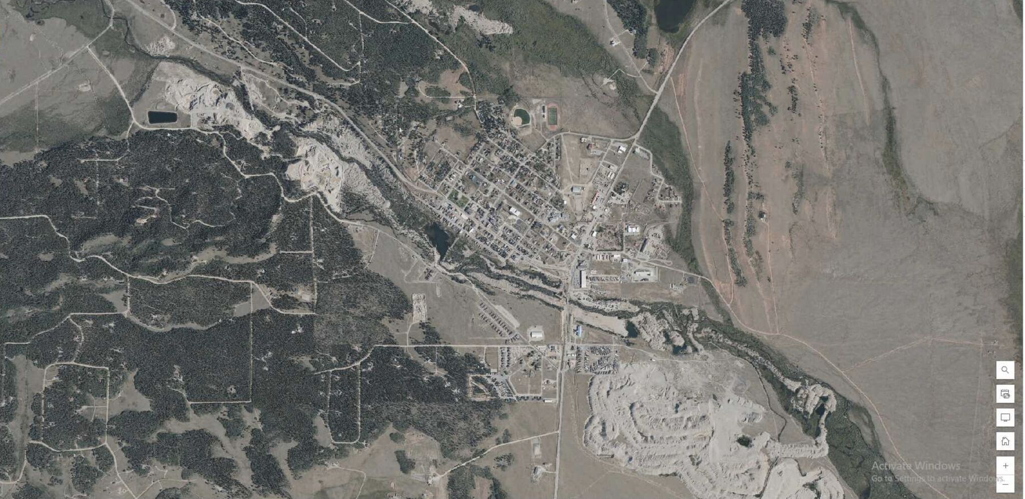
Creating CAD imagery basemap using Vexcel Imagery
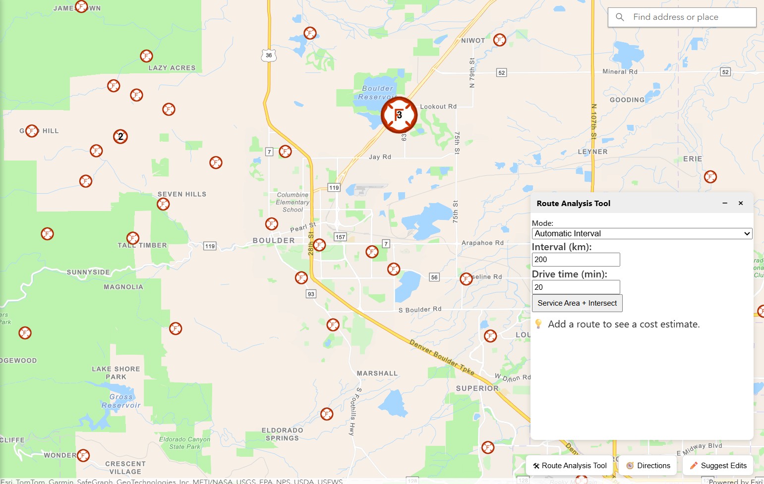
Custom Routing Solution using Open Routing Service API
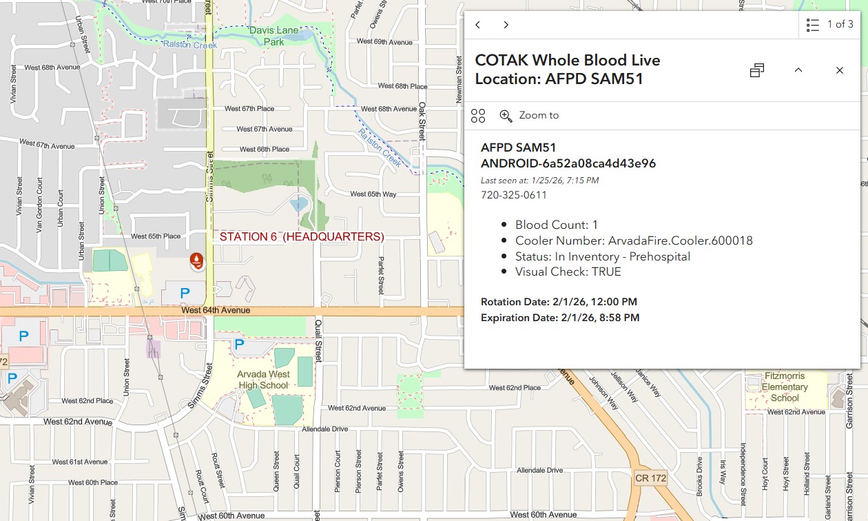
Whole Blood Real-Time Tracking in ArcGIS Online
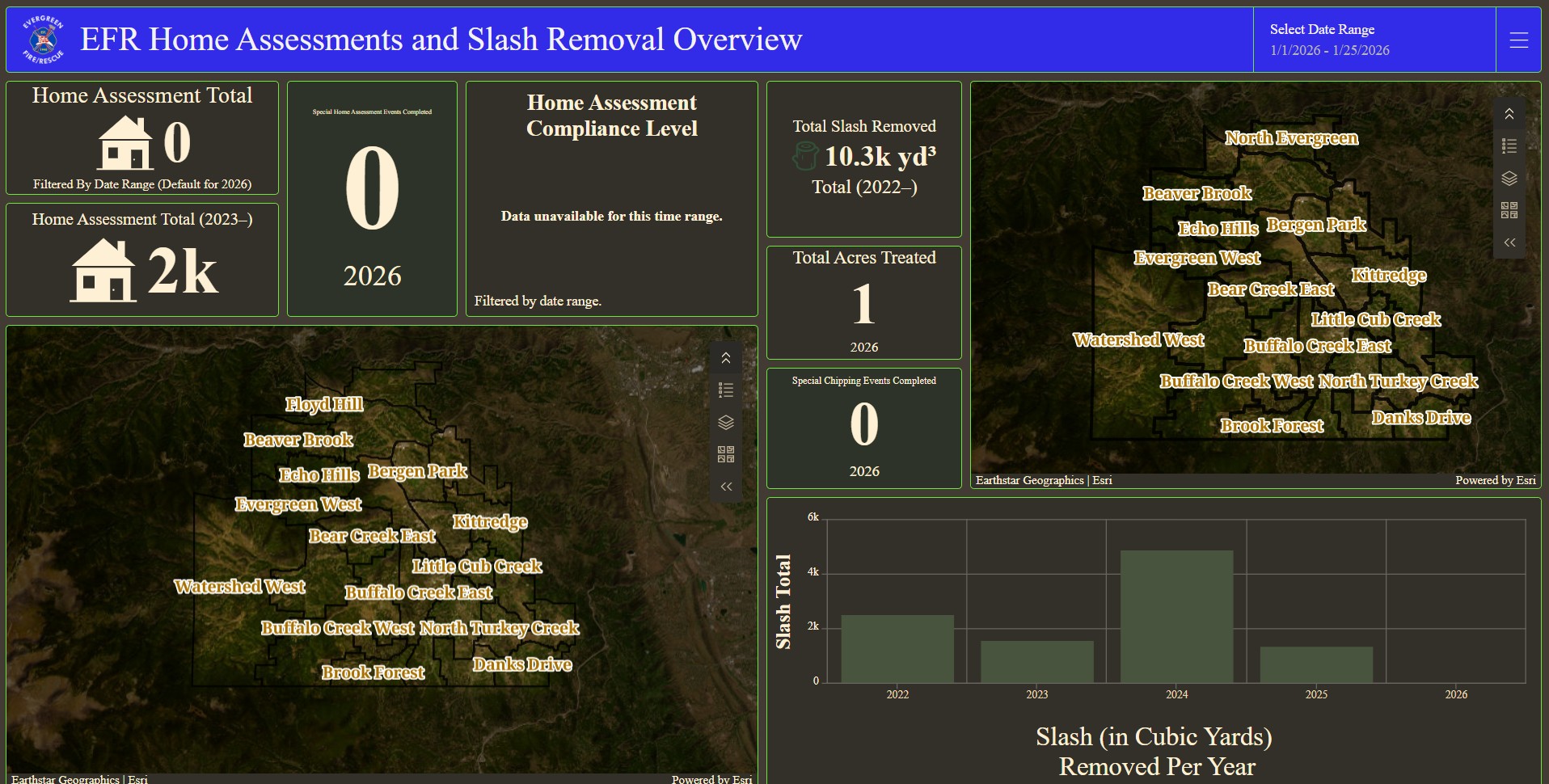
Evergreen Mitigation Field Maps and Dashboard
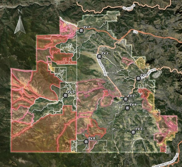
Understanding Delays and Improving Emergency Response with GIS - Evergreen Fire Department in Evergreen, Colorado
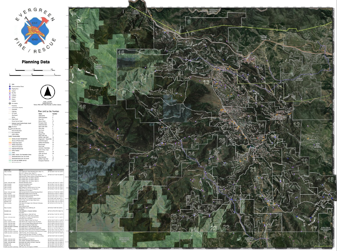
Evergreen Fire Operational Maps
Contact
Please feel free to contact me at my email address or through my LinkedIn Account below.