Evergreen Fire Rescue Operational Maps
Agency:
Evergreen Fire Rescue
Agency:
Evergreen Fire Rescue
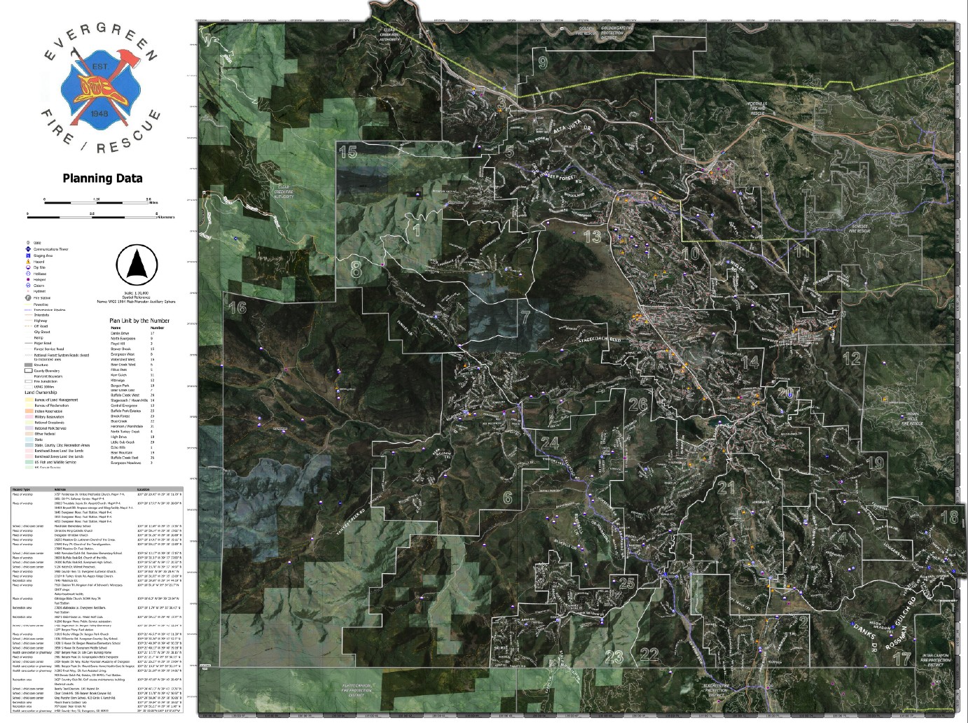
Project Description:
These map products were developed for Evergreen Fire Rescue as standardized operational planning deliverables at a target scale of 1:30,800. The products depict plan unit zones derived from prior Community Wildfire Protection Plan (CWPP) analysis conducted in coordination with the Ember Alliance. Plan units are delineated using ingress and egress accessibility, population distribution, and additional defined operational risk criteria, and are utilized to support evacuation planning and execution within the district.
Geospatial datasets relevant to emergency operations were compiled, normalized, and overlaid on the plan units, including water sources, hydrants, identified hazards, communications infrastructure, and other response-critical assets. Source data was integrated from the dispatch CAD system, Homeland Infrastructure Foundation-Level Data (HIFLD), and locally maintained authoritative datasets. All data underwent validation, sanitization, and standardization and was symbolized in accordance with National Wildfire Coordinating Group schema to ensure consistency, interoperability, and reuse.
Basemap context layers include district and county administrative boundaries, parks and protected lands, trail networks, and other reference features necessary to support situational awareness and operational navigation.
Final deliverables were produced for both hardcopy display at stations and offices and for digital distribution for department-wide use in Avenza Maps. The standardized datasets are maintained and reused across additional operational products, including initial attack and incident response map series booklets.
Evergreen Fire Rescue Operational Maps
Please feel free to contact me through my LinkedIn Account below.