Creating CAD imagery basemap using Vexcel Imagery
Agency:
Jeffcom
Skills:
ArcGIS Enterprise deployment
ArcPy
Agency:
Jeffcom
Skills:
ArcGIS Enterprise deployment
ArcPy
Project Description:
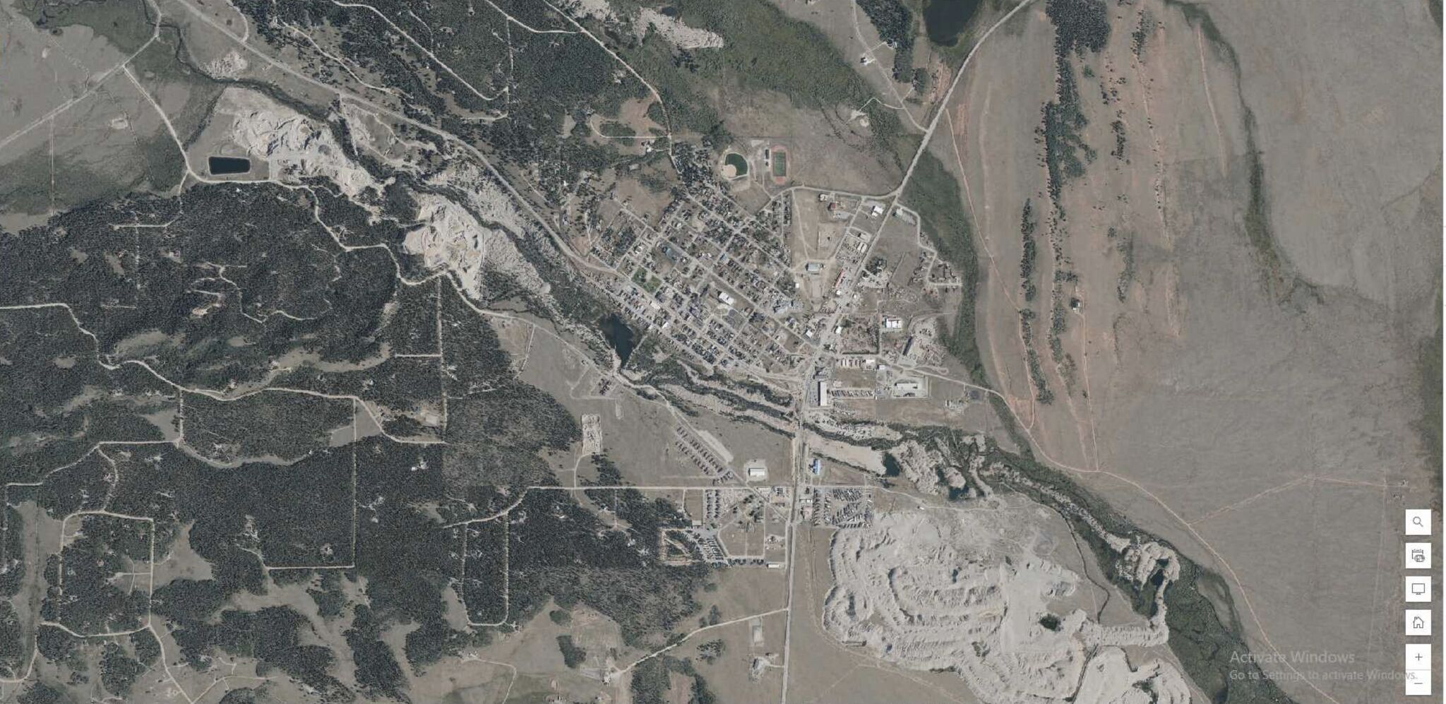
Due to CJIS compliance standards, Jeffcom911 operates its Computer-Aided Dispatch (CAD) system on a network behind a secure firewall, with limited internet access. Each dispatcher runs the associated CAD map locally. In previous deployments of imagery basemaps, tiles were also stored and referenced locally. When the dispatch center expanded to cover a second county and a third as a mutual aid area, the combined tile dataset became too large for individual machines to store. To address this, a local instance of ArcGIS Enterprise Server was deployed on the network to serve tile packages as referenced URLs within the CAD environment.
While each county provided imagery via the DRCOG program on a bi-annual basis, Park County—added as a mutual aid area—had no available tile dataset. To resolve this gap, 50,000 tiles from the Colorado State/Vexcel Imagery program were downloaded, processed with a custom script, and consolidated into a single mosaiced ECW basemap covering the full three-county region.
The collaboration between the CDOT Division of Transportation Development and the Colorado Office of Information Technology (OIT) has resulted in the acquisition of statewide high-resolution imagery from Vexcel®, offering a significant enhancement in data resources for the region. This initiative provides local agencies with access to a variety of imagery, including statewide coverage at 15-20 cm (5.9-7.8 in.) resolution collected biannually, annual urban area coverage at 7.5 cm (3 in.) resolution, and specialized coverage like "Gray Sky" imagery captured at 3 in. resolution immediately following major disasters. To ensure accessibility, the data is distributed through various channels, including a high-performance Web Map Tile Streaming (WMTS) service and an online map viewer. Agencies who take part in the initial training are granted access to the Vexcel server via provided logins and access tokens.
The script here allows for mass extraction of TIFFs by iterating through a tessellation grid, replacing polygon values with minimum and maximum coordinates generated from the grid. The size of tessellation squares is determined using an initial TIFF extraction as a reference. By dynamically constructing API URLs for each polygon, the script downloads imagery from the Vexcel API, providing public safety agencies with offline access to high-resolution imagery spanning large geographic areas.
Hosting ArcGIS on a CAD Network: Technical Manual
Please feel free to contact me through my LinkedIn Account below.